


Please Leave Us A Message
Privacy statement: Your privacy is very important to Us. Our company promises not to disclose your personal information to any external company with out your explicit permission.
 Chengdu JRT Meter Technology Co., Ltd
Select Language
 August 07, 2019
Field data acquisition is a long-standing problem for surveyors, cartographers, GIS database managers, engineers and researchers. The problem is simple: how to accurately collect location and physical feature data for mapping, cataloging, resource inventory and storage in the database.
In a given situation, finding out the results of this problem is annoying. Because:
(1) There may be many methods and technologies that can be used;
(2) In most cases, no single method can provide complete and satisfactory results.
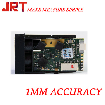
The application of laser technology, especially the Laser Rangefinder developed by American Laser Technology Corporation (LTI), has been perfected since 1990, when the Forestry Bureau of the United States Department of Agriculture acted as a field survey prototype and evaluated its future development and application. It can connect with data collector and GPS, and can configure various kinds of software to make forestry possible. Measurement has been promoted from hand-operated compass, rope belt, tiltmeter and old telescope to the era of single-person operation, full station and comprehensive multi-purpose instrument.
The measurement system designed by LTI is suitable for basic vegetation resources and wood sales inspection and planning, logging volume distribution map and road survey and measurement. By June 1993, the U.S. Forestry Administration had purchased more than 150 of these instruments. In the field planning of USDA Forestry Bureau, the laser rangefinder is not only fully functional and durable, but also cost-effective, especially in areas where the target is not clear. From shrubbery in northern Idaho to rainforests in southeastern Alaska, this is evident.
China, with vast resources, has abundant forestry resources. With the large-scale production brought about by the reform and opening up, forestry plays an increasingly important role in the national economy, and the demand for commercial timber increases sharply. How to plan the development of forestry, measure the forestry resources more accurately, and inventory and catalogue the forestry resources with the emphasis on timber sales has become an important issue for the forestry sector. The introduction of laser measurement technology will help to push our country's forestry measurement technology into a new era.
The above is the Application of Laser Range Finder in Forestry we have listed for you. You can submit the following form to obtain more industry information we provide for you.
You can visit our website or contact us, and we will provide the latest consultation and solutions
Send Inquiry
Most Popular
lastest New
Related Products
Send Inquiry
About Us
Related Products List
Contact Us

Privacy statement: Your privacy is very important to Us. Our company promises not to disclose your personal information to any external company with out your explicit permission.
Fill in more information so that we can get in touch with you faster
Privacy statement: Your privacy is very important to Us. Our company promises not to disclose your personal information to any external company with out your explicit permission.