


Please Leave Us A Message
Privacy statement: Your privacy is very important to Us. Our company promises not to disclose your personal information to any external company with out your explicit permission.
 Chengdu JRT Meter Technology Co., Ltd
Select Language
 August 02, 2019
China, with vast resources, has abundant forestry resources. With the large-scale production brought about by the reform and opening up, forestry plays an increasingly important role in the national economy, and the demand for commercial timber increases sharply. How to plan the development of forestry, measure the forestry resources more accurately, check and catalogue the forestry resources more accurately focusing on timber sales, has become an important issue for the forestry sector. Laser measurement technology will be helpful to promote our country's forestry measurement technology into a new era.
Application of Multi-function Laser Measurement System
(1) Distance measurement - Distance measurement is the main function of this instrument. It can directly display horizontal or inclined distance.
(2) Azimuth - The magnetic azimuth or relative azimuth of the measured target can be displayed directly.
(3) Inclination angle - can show inclination angle (vertical angle) or percentage of inclination.
(4) Target coordinate program-Target program function is the so-called location or stake-setting (lofting) function in surveying, that is, to input its coordinates (X, Y, Z) into the instrument at a known point, and to measure the alignment measurement target, the coordinates of the measured position can be displayed immediately.
(5) Height measurement - using the principle of triangulation (pitch, elevation and horizontal distance) to measure the height of objects, including tree height, building height and so on.
(6) Measuring function - This instrument has another special function program. It can directly enter the measuring function, carry out the measuring work and automatically store azimuth, distance, tilt angle and other data. It can also be input into a computer and processed by PC software.
(7) Navigation function - because it has a fluxcompass, it can act as a navigation function.
Application of Multifunctional Laser Measurement System in Forestry
(1) Combination of Multi-function laser measuring Instrument and GPS
The introduction of multi-function laser measuring instrument was mainly combined with GPS, that is, GPS in the terrain restricted areas with multi-function laser measuring instrument for measurement.
Specific applications:
Banning and Inventory of Overreclaimed Land
It is the hottest research project for academic institutions to use laser measuring instrument, GPS, GIS and their software to cooperate with portable computer for environmental monitoring. In forestry, land reclamation is banned and inventory application, but because the use of GPS may be limited by terrain, further research and testing are needed. In addition, it can also be combined with digital cameras to shoot and file violations for evidence of prohibition.
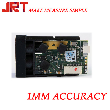
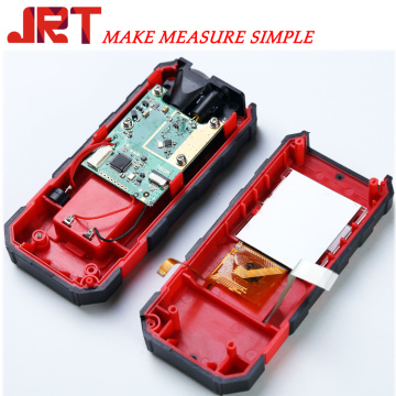
The above is the Characteristics and Application of Industrial Laser Range Finder we have listed for you. You can submit the following form to obtain more industry information we provide for you.
You can visit our website or contact us, and we will provide the latest consultation and solutions
Send Inquiry
Most Popular
lastest New
Related Products
Send Inquiry
About Us
Related Products List
Contact Us

Privacy statement: Your privacy is very important to Us. Our company promises not to disclose your personal information to any external company with out your explicit permission.
Fill in more information so that we can get in touch with you faster
Privacy statement: Your privacy is very important to Us. Our company promises not to disclose your personal information to any external company with out your explicit permission.